Property Details
Carnwath South Lanarkshire ML11 8LR
Description
An area of peat moss with potential peat restoration and carbon sequestration opportunities
Commercial - Carnwath South Lanarkshire
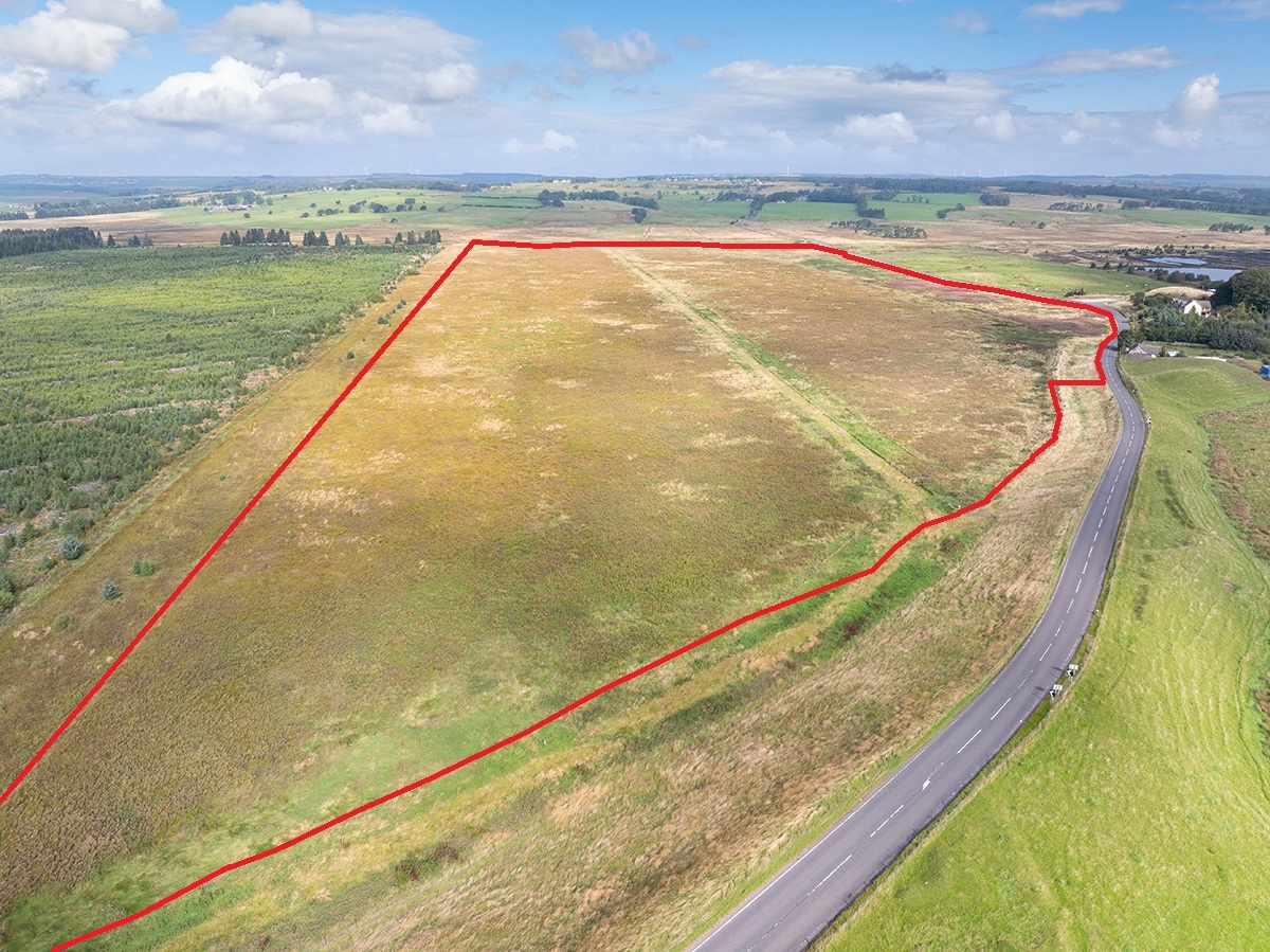
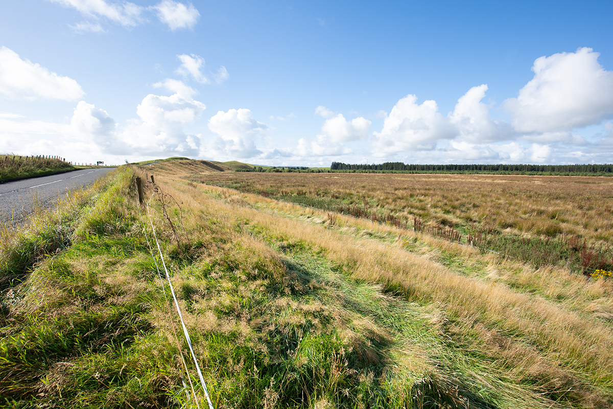
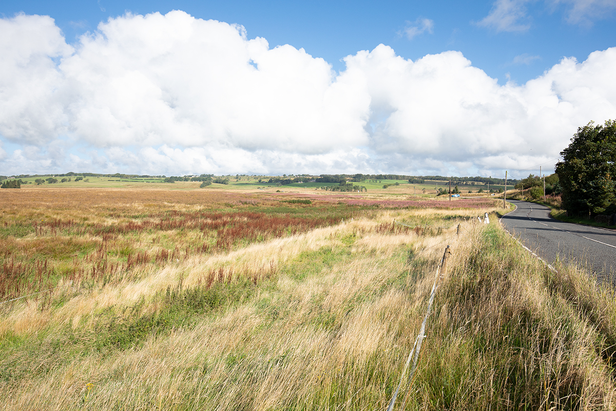
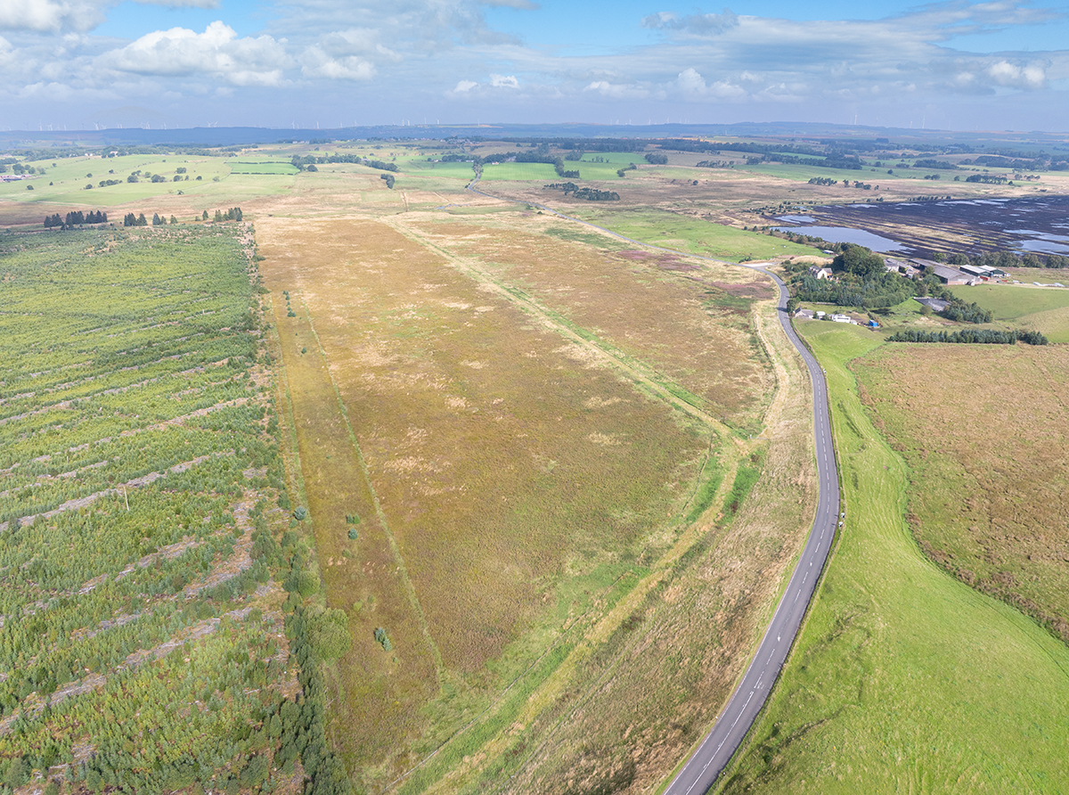
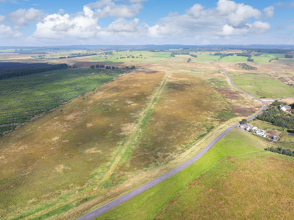
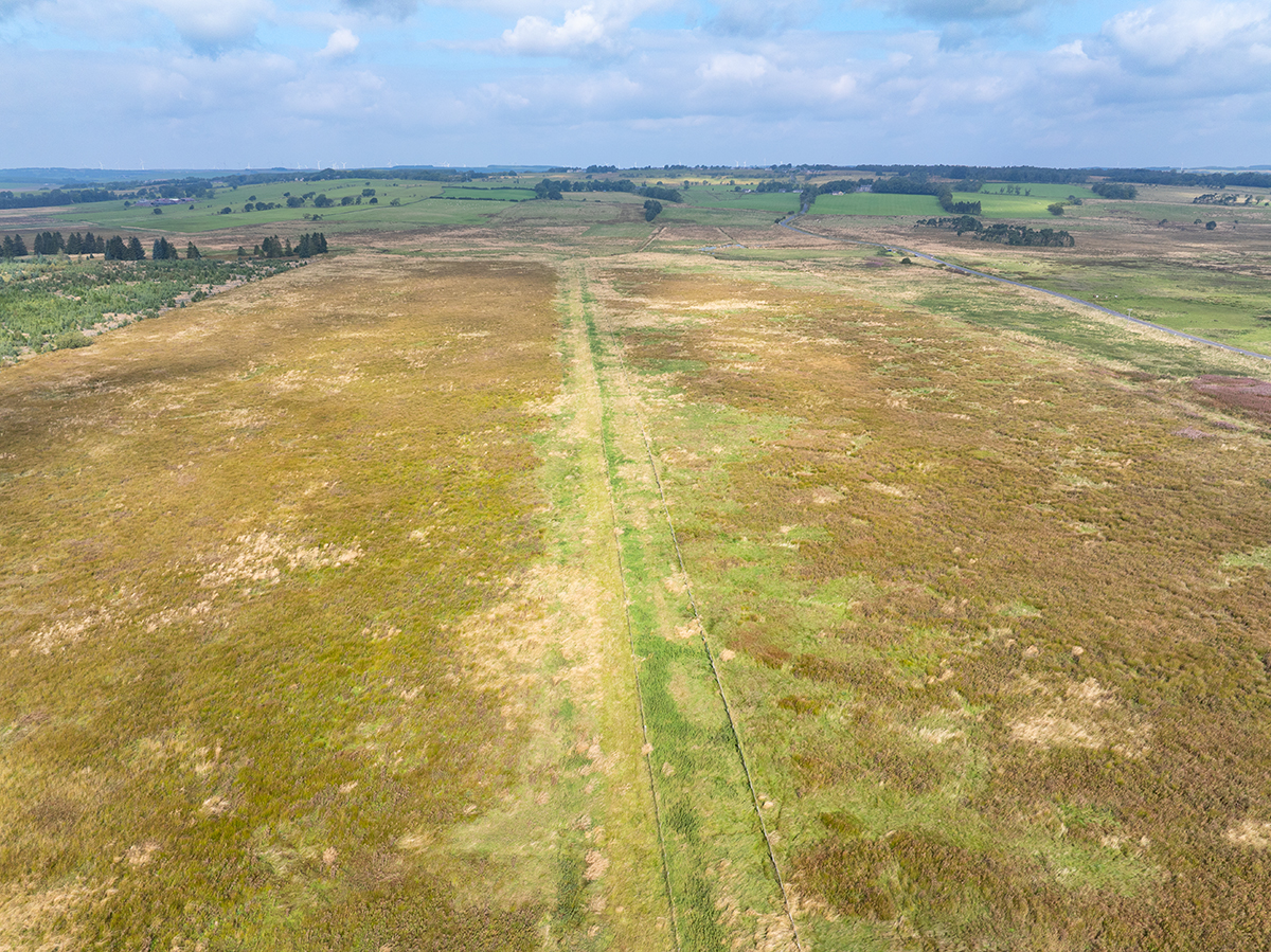
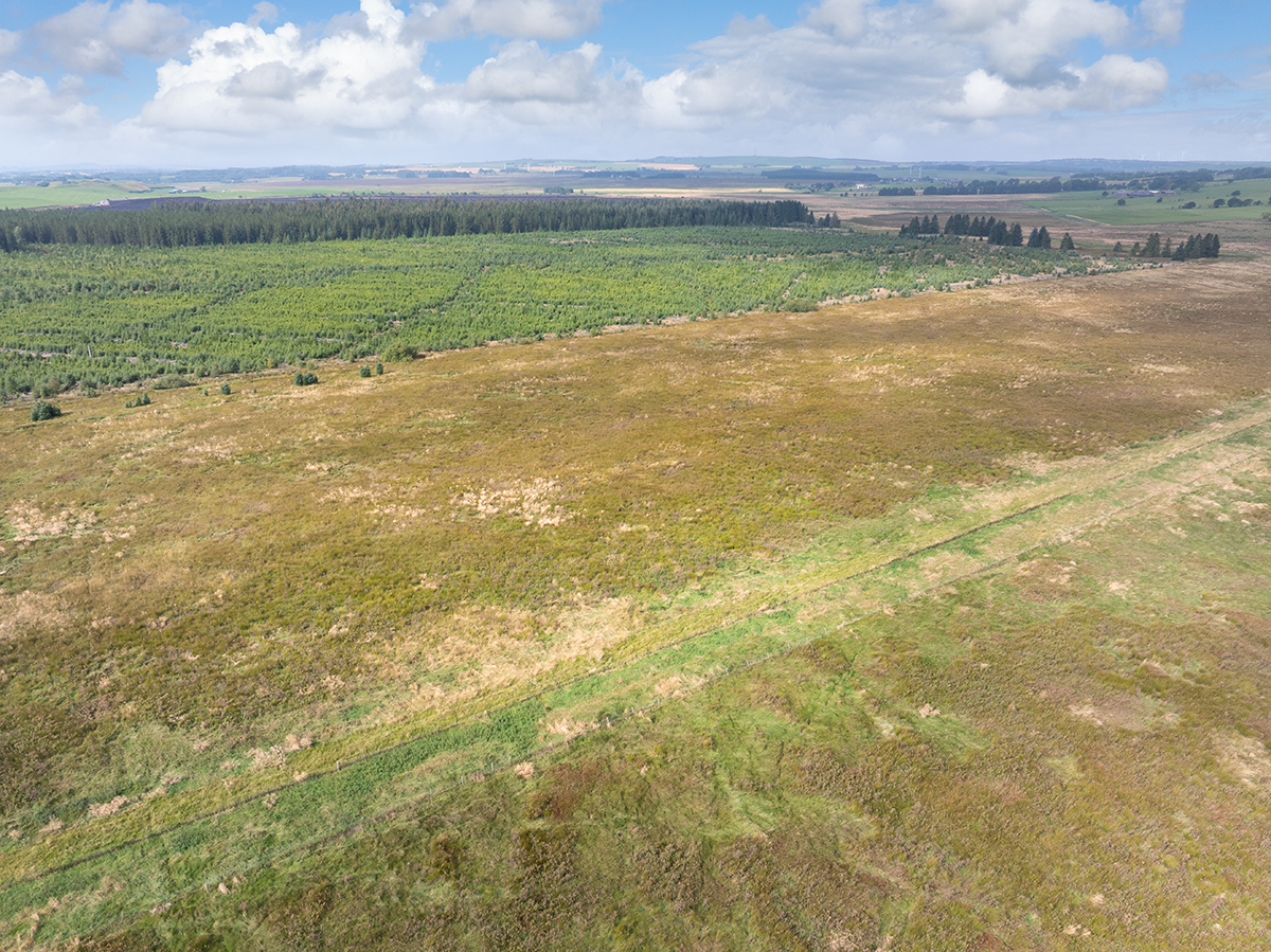
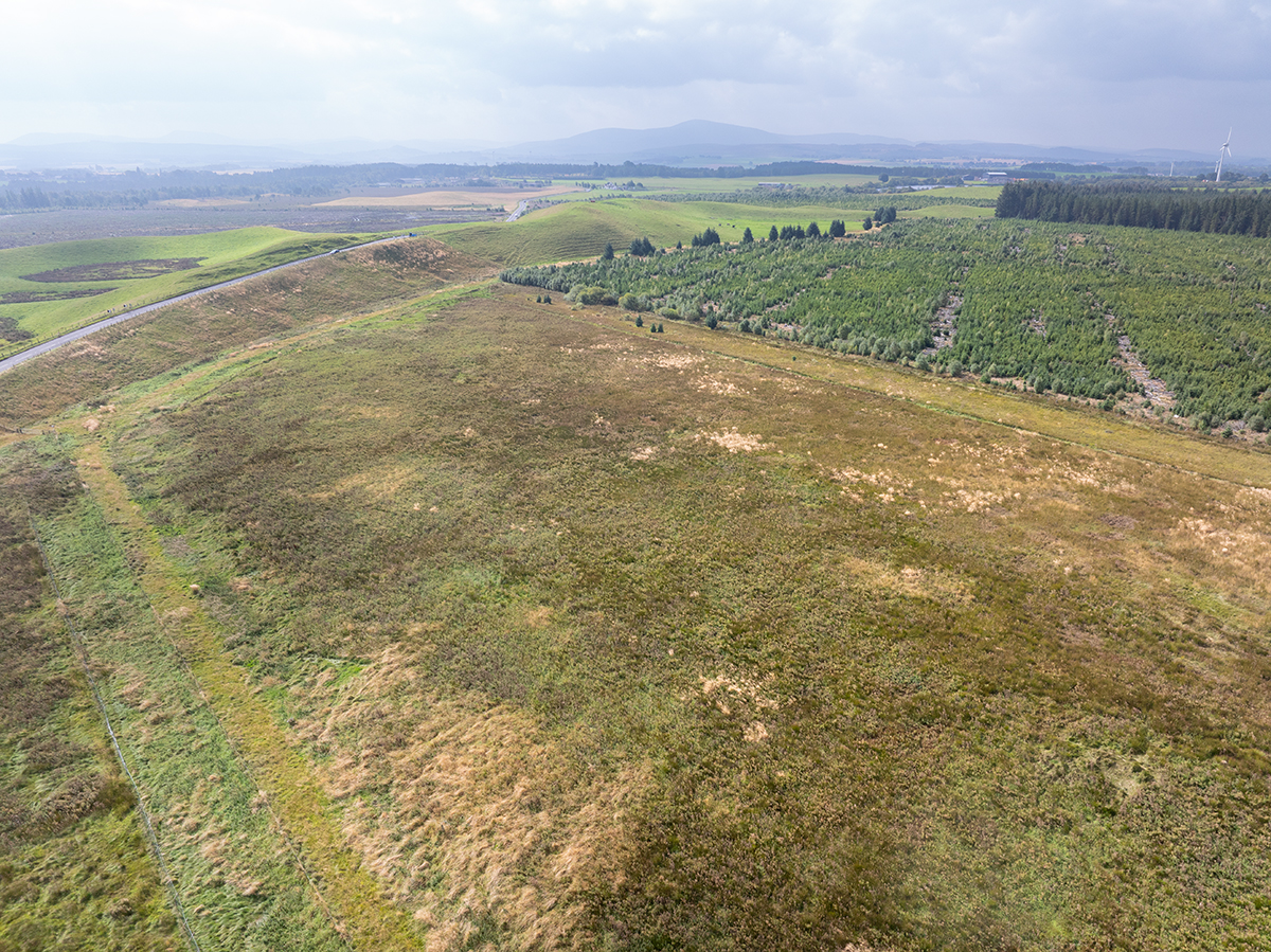
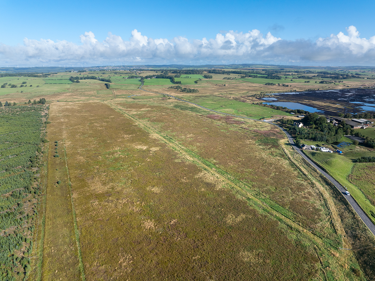
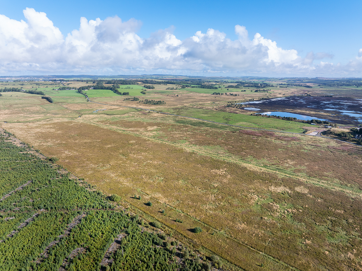
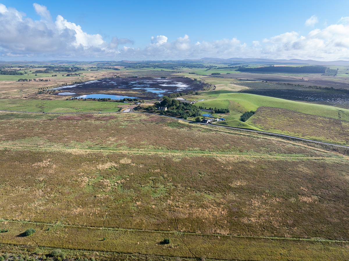
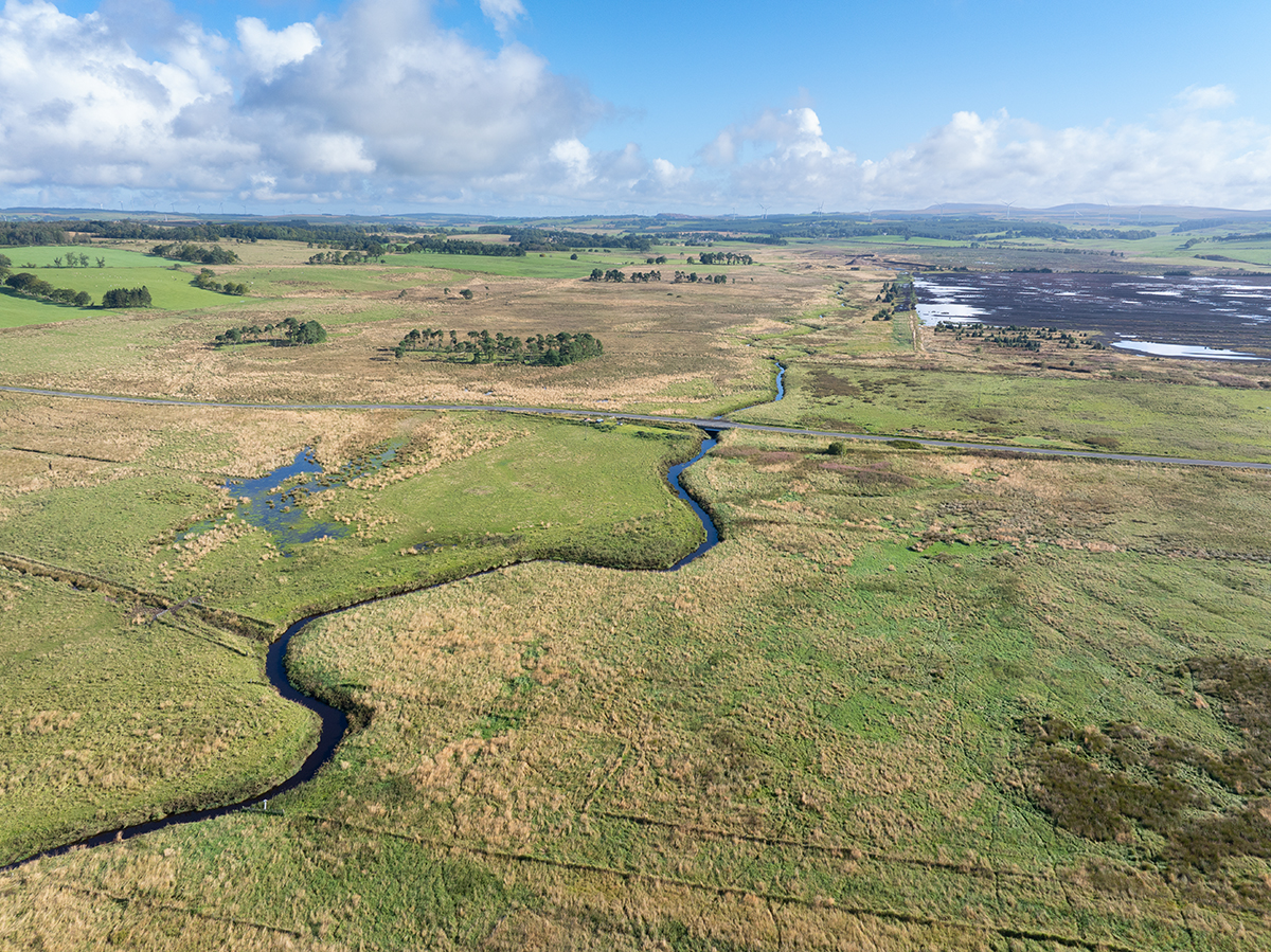
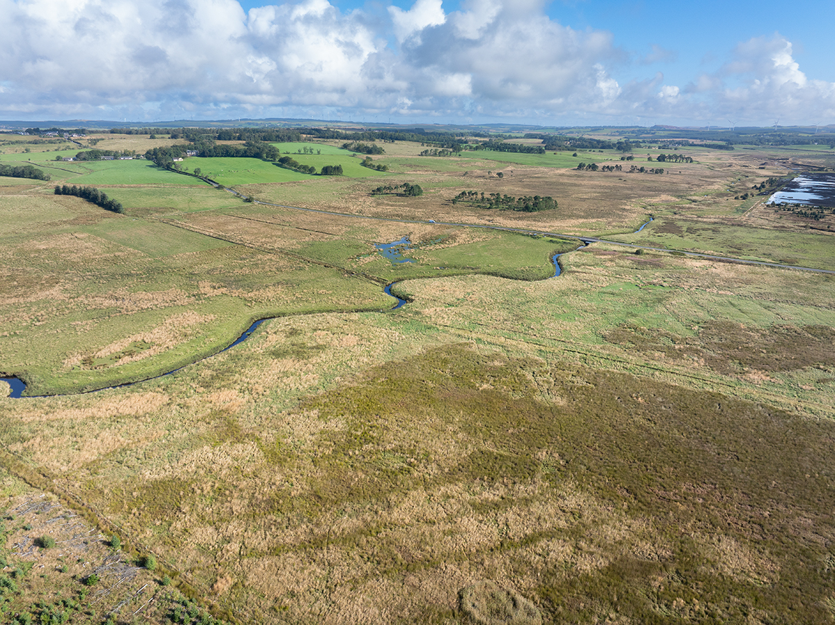
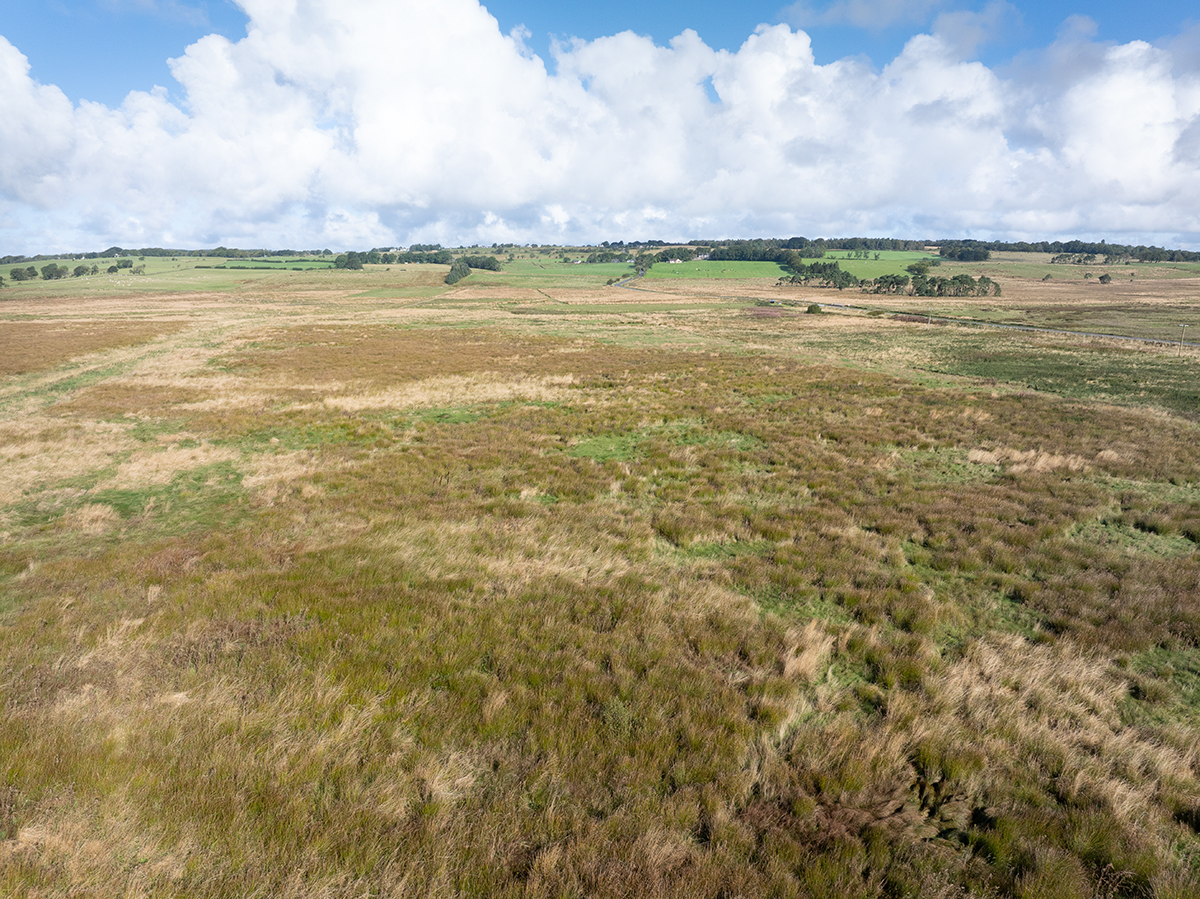
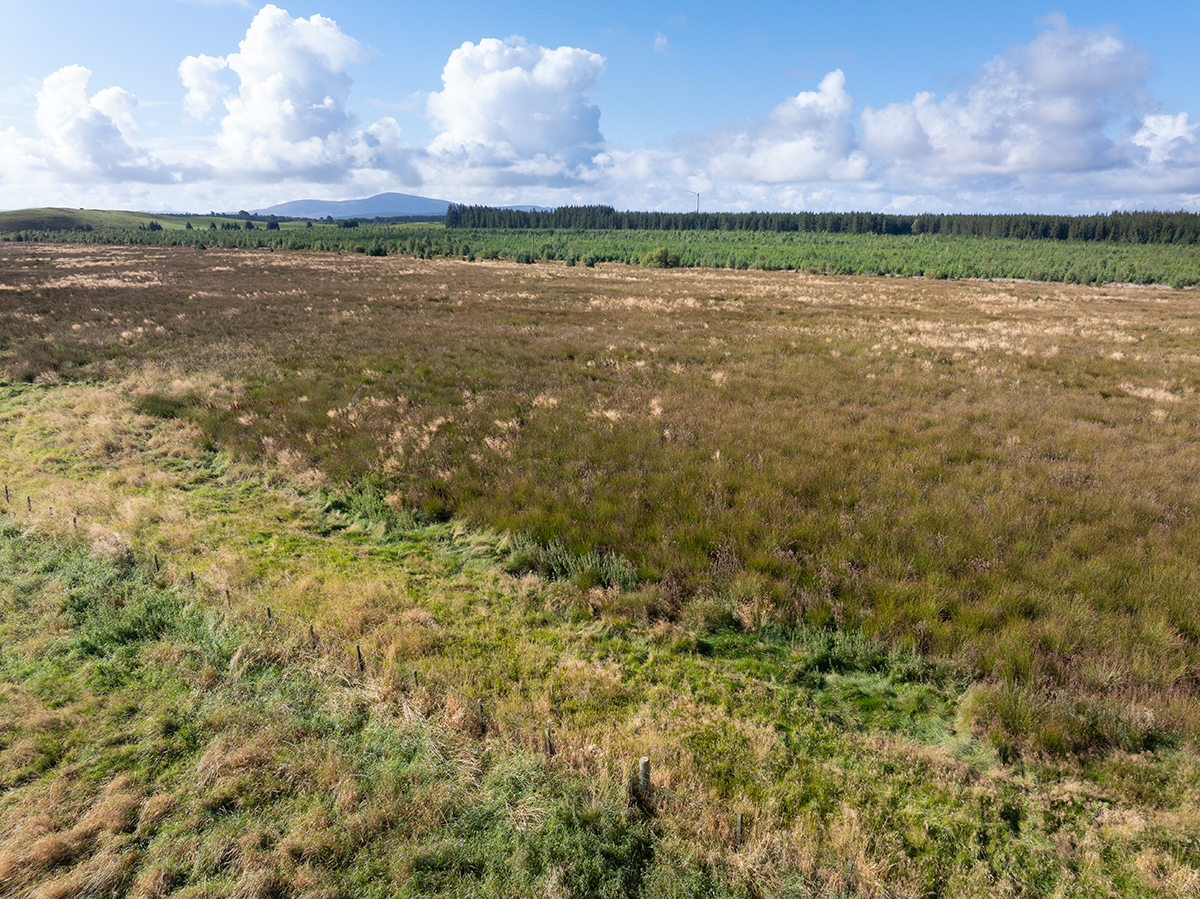
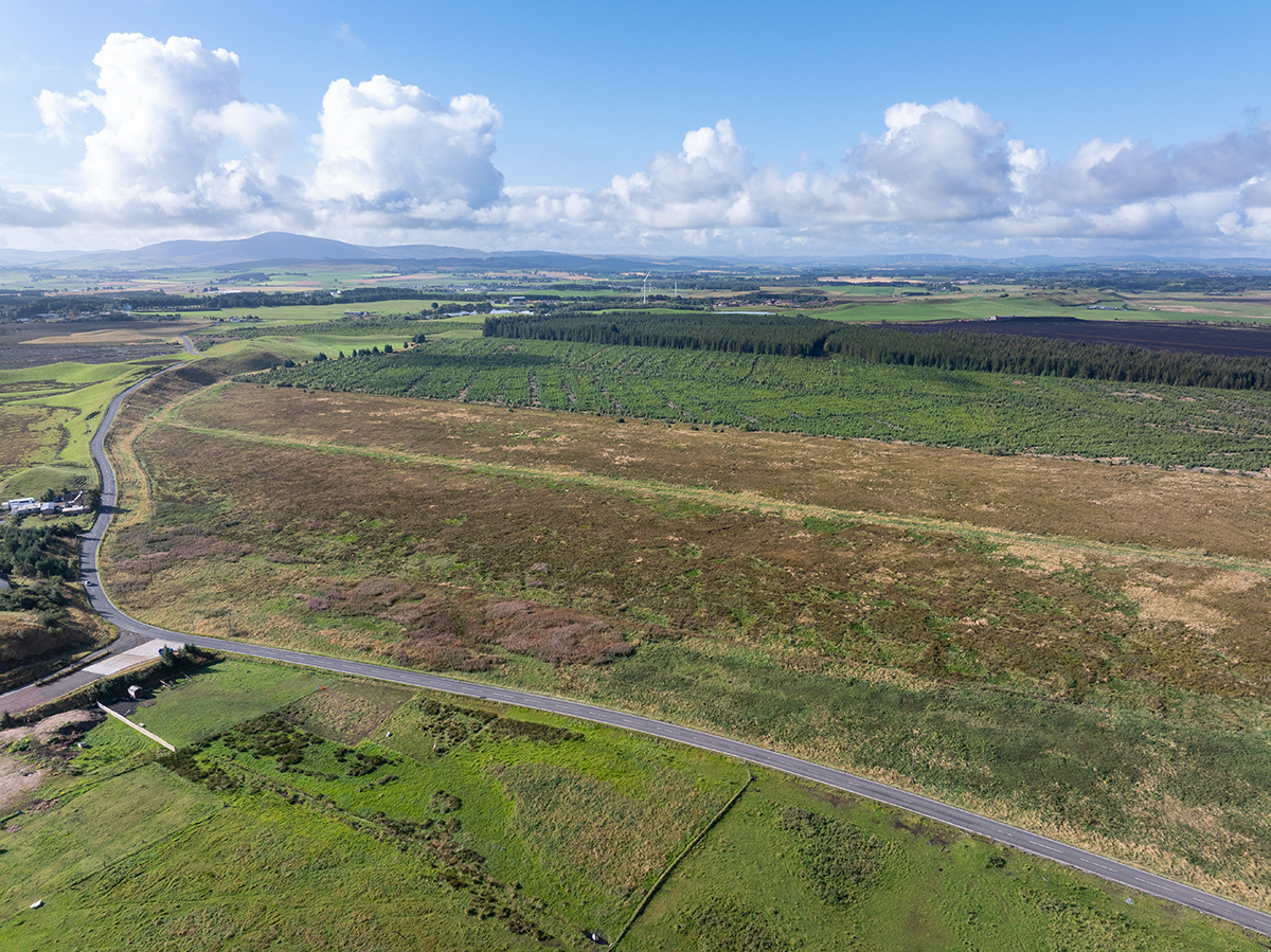
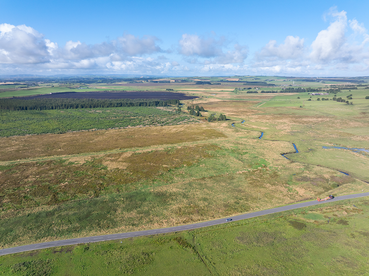
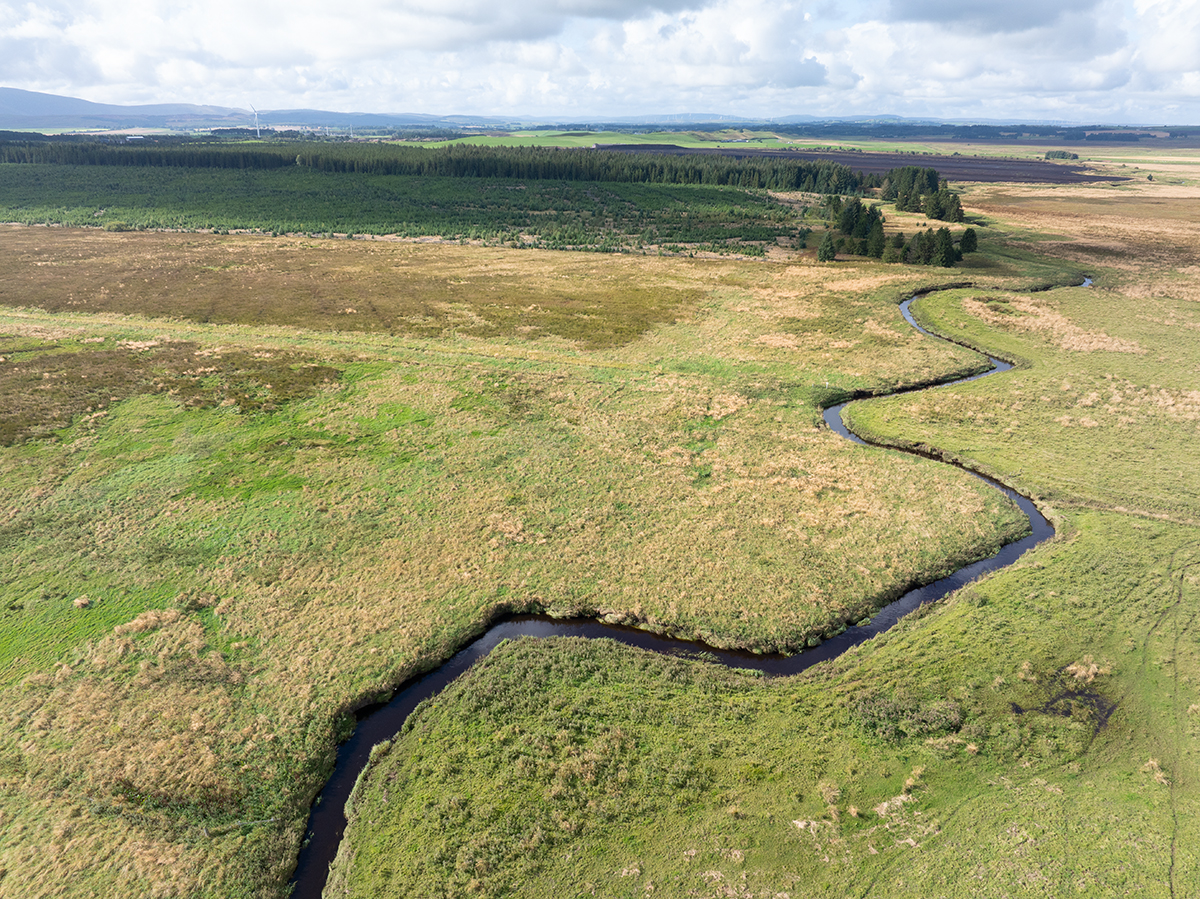
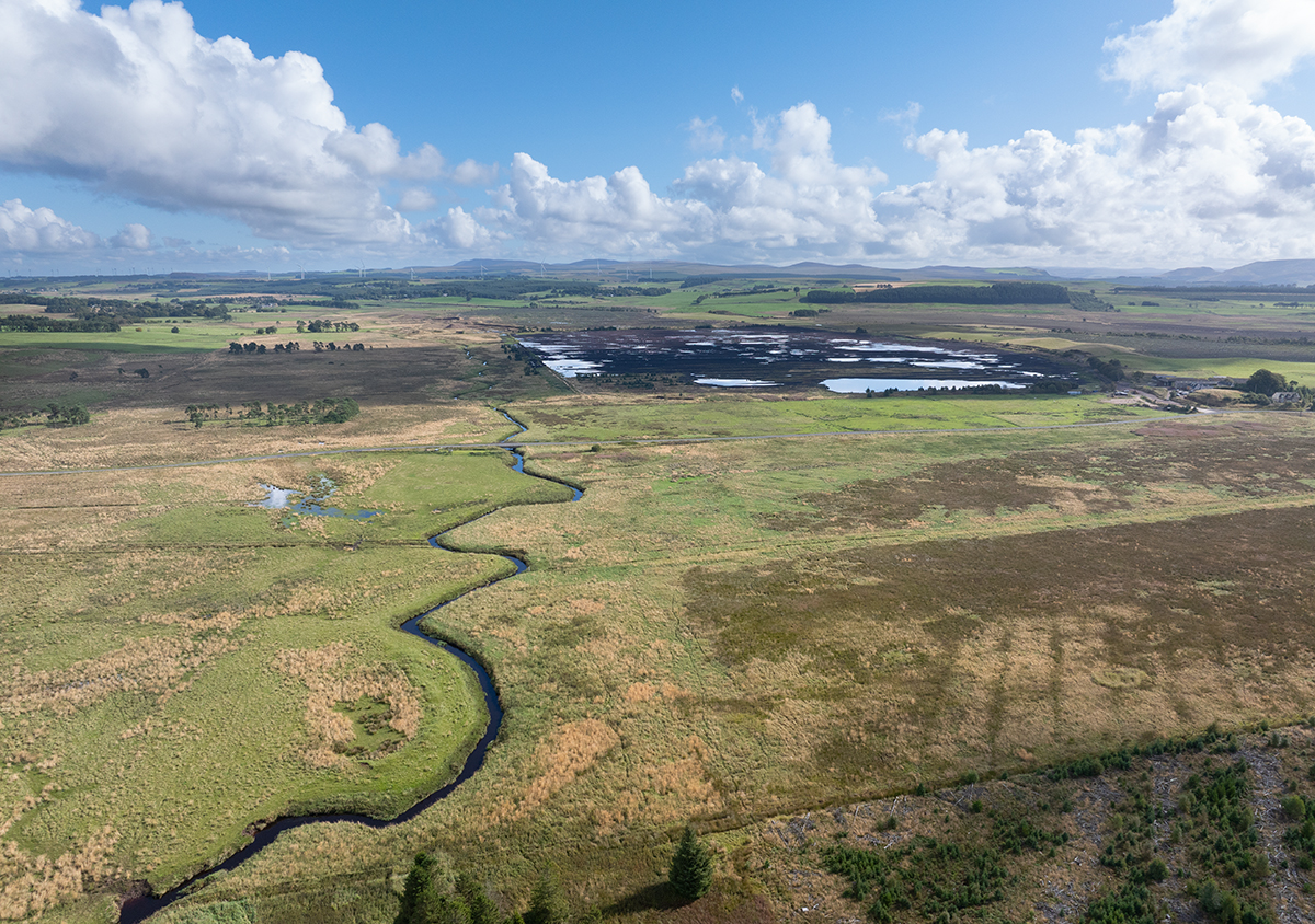
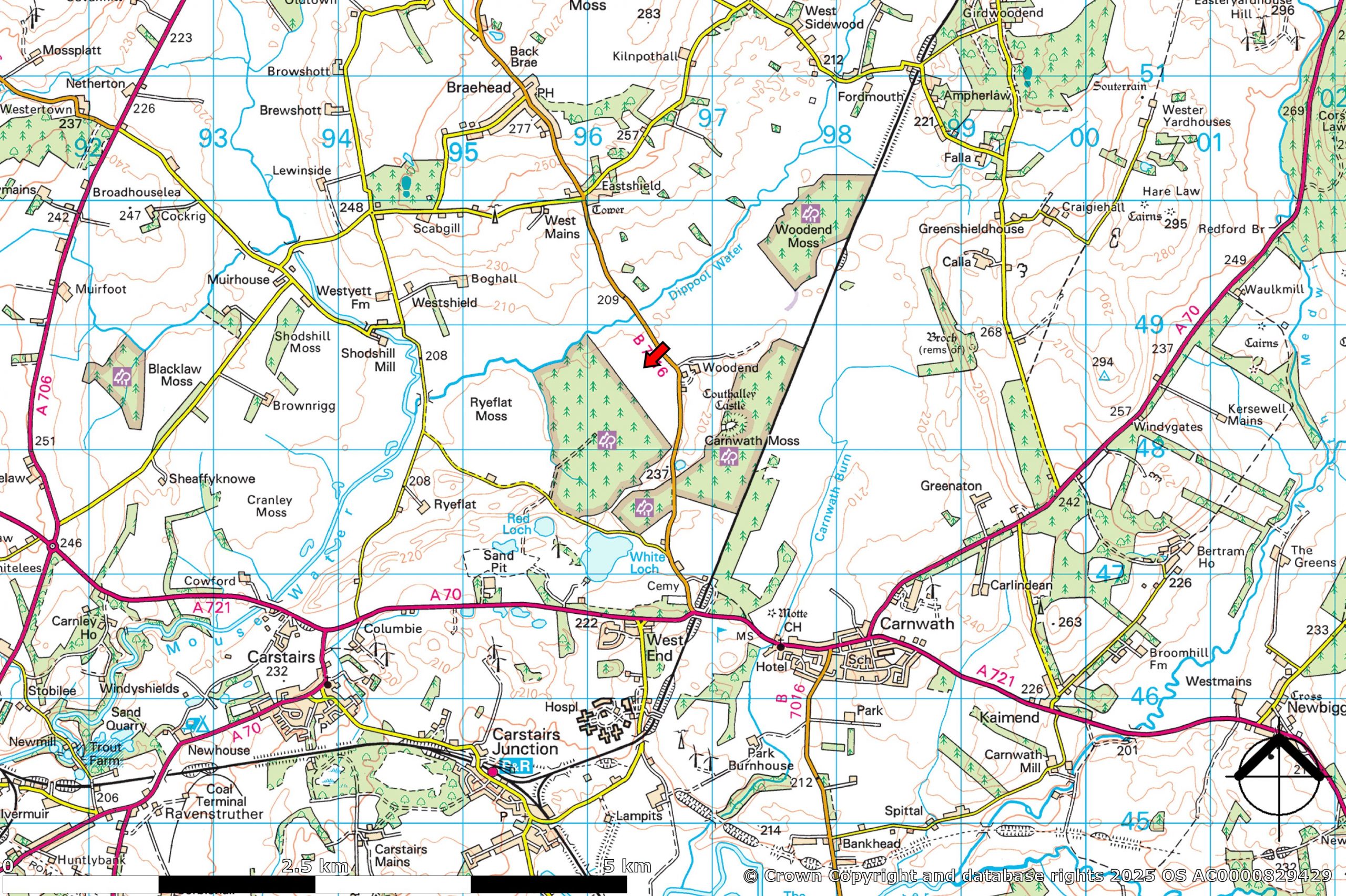
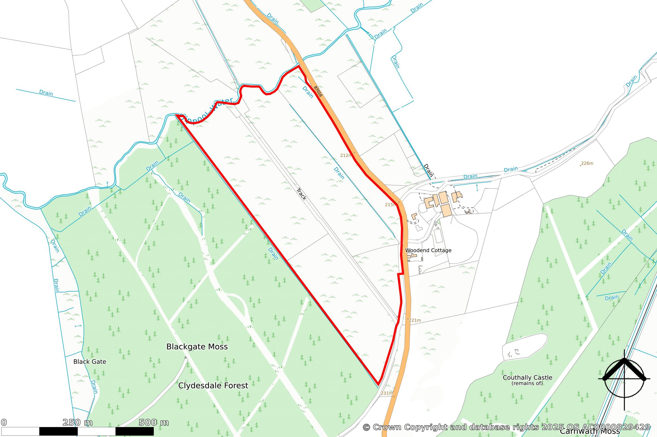
The land comprises a section of Blackgate Moss, which is accessed directly off the adjoining B7016 public road. The majority of the land is thought to have been historically harvested for peat, but significant peat depths remain.
Currently, the land is not occupied or grazed. Small areas to the south and east are potentially capable of restoration to livestock or pony summer grazings.
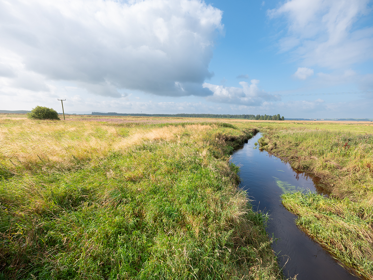
The overall site lies at a height of between 210 and 215m above sea level and is generally level, draining to the north into the Dippool Water, which forms the northern boundary.
A gas pipeline, with associated drainage and mineral infill, runs through the middle of the land.
The land has been historically drained in association with likely peat harvesting and the construction of the pipeline.
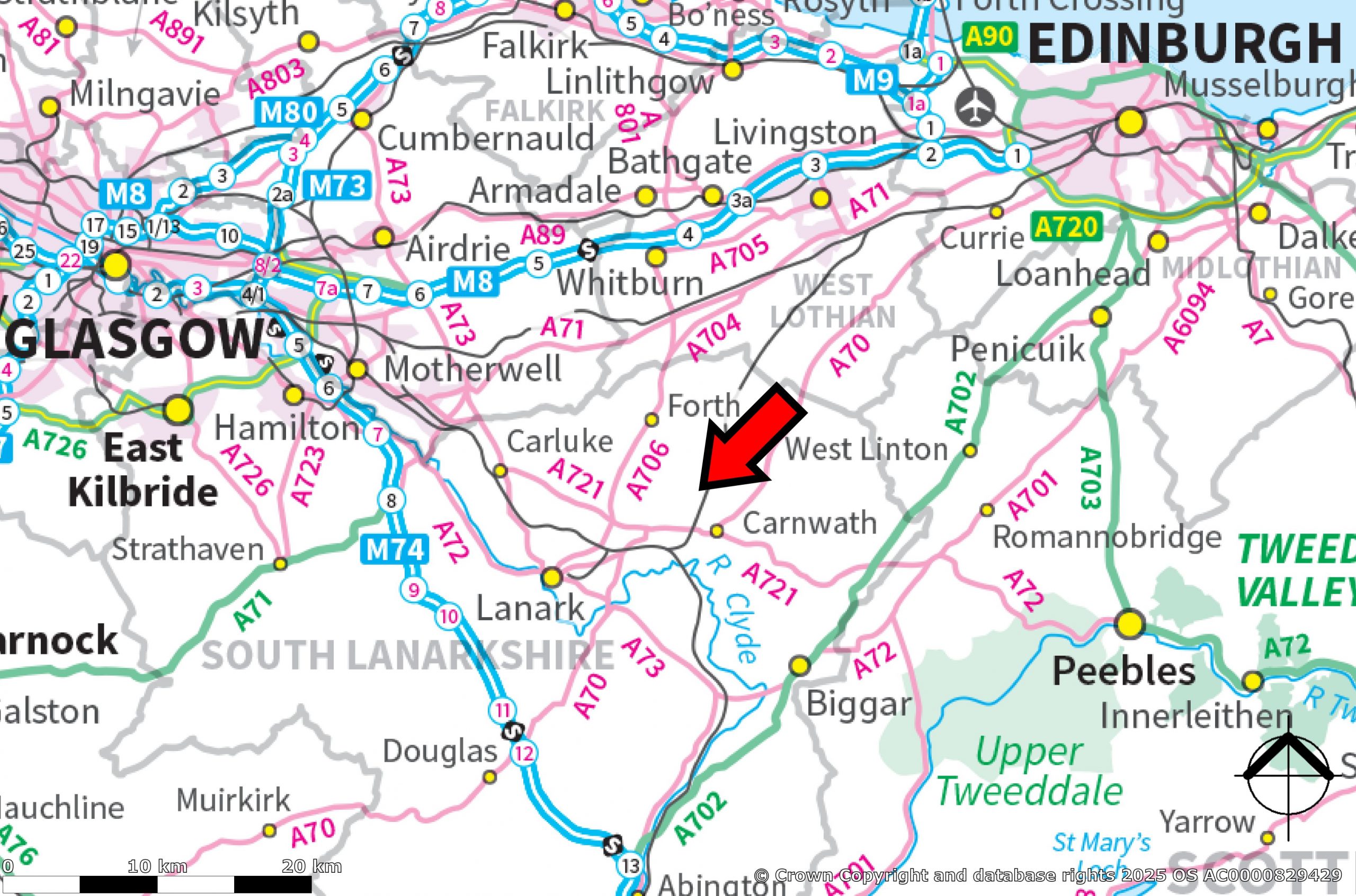
LOCATION
The land lies approximately 2 miles north-west of Carnwath, with Edinburgh city centre lying approximately 27 miles to the north-east and Glasgow city centre approximately 34 miles to the north-west. It sits within a rural area with open grassland to the north-west and south-east; commercial forestry plantation to the south-west; and a former peat harvesting site to the north-east.
Post Code: ML11 8LR. It is strongly recommended that you do not rely on a Satnav in this rural location and check on a route map prior to any scheduled viewing.
What3Words: ///settled.chestnuts.ivory
DIRECTIONS
Travelling from the north-east (Edinburgh), head south on the A70 to Carnwath. In the town, turn right at the roundabout junction onto the A721. Continue through the town (Main Street) and carry on out, past the golf course. Approximately a quarter of a mile from the edge of the town, just after the railway bridge, turn right onto the B7016 (sign posted – “Braehead 3; Wilsontown 5; Carnwath Cemetery”) and continue for a further mile until the road passes Woodend Farm on the right. Access to the land is directly opposite the Woodend Farm entrance. There is no space for cars to park off the public road at this point, but cars can be parked approximately 100 yards further on at the bell mouth access to the former peat works, but please avoid blocking this entrance, as vehicles need access at all times.
From Glasgow, take the M8 east to Junction 6 and then travel south on the A73 to the Carluke. Follow the signs within Carluke to “Peebles A721”, turning left at the traffic lights, then right at the first roundabout and left at the second roundabout. Continue on the A721 out of Carluke, heading for Carnwath. At the Harelaw Roundabout, continue straight on and keep on the A721 for another three miles. Just after the village of Westend, turn left onto the B7016 (sign posted – “Braehead 3; Wilsontown 5; Carnwath Cemetery”) and continue, as described above.
PEAT RESTORATION
The land has been surveyed to establish the current peat resource, with the deepest deposits identified towards the south, with depths over 4 m, but with depths in other areas of between 2 and 3.5 m.
The peat condition is currently considered to be dry and in poor condition, with open ditches and signs of underground drains.
The peat may therefore be suitable for restoration and as such may qualify for Peatland ACTION funding. This scheme is administered on behalf of Nature Scot, within the South Lanarkshire area, by Glasgow & Clyde Valley Green Network Partnership. The next NatureScot Peatland ACTION application deadline is 30 September 2025 for projects with an intended start date after 01 April 2026.
The Town and Country Planning (General Permitted Development and Use Classes) (Scotland) Amendment Order 2020, introduced a new Class 20A, specifying permitted development rights for peatland restoration projects. Full planning permission is not required for peatland restoration projects but will require prior notification / prior approval.
Interested parties should satisfy themselves in this regard.
PEATLAND CODE
The Peatland Code is part of the International Union for Conservation of Nature (IUCN) UK Peatland Programme. It is a voluntary certification standard for UK peatland projects wishing to market the climate benefits of peatland restoration and provides assurances to voluntary carbon market buyers that the climate benefits being sold are real, quantifiable, additional and permanent.
The land may qualify for Peatland Code certification, however, interested parties should satisfy themselves in this regard. Further information is available from Nature Scot or Glasgow & Clyde Valley Green Network Partnership.
LAND USE CLASSIFICATION
All of the land is identified by the James Hutton Institute for agricultural use as Grade 5:3 and for forestry use as F5 (although peat depths will restrict any tree planting).
INTEGRATED ADMINISTRATION AND CONTROL SYSTEM (IACS) & BASIC PAYMENT SCHEME (BPS) ENTITLEMENTS
The land is not registered for IACS (Integrated Administration and Control System) purposes and no Basic Payment Scheme (BPS) entitlements are available.
AREAS
The land totals approximately 34.9 Ha (86.3 acres).
TENURE
The land is offered on an Heritable title basis, with vacant possession.
ACCESS
Direct access to the land is from the public road, via an old field gate opposite the entrance to Woodend Farm.
PLANNING
The land is not subject to any planning applications or permissions.
The land is shown within the South Lanarkshire Local Development Plan 2 (adopted April 2021) as being in a “Rural Area” with a significant part lying within an “Ethylene Pipeline Hazard Zone”.
THIRD PARTY RIGHTS AND SERVITUDES
An ethylene gas pipeline crosses the land centrally from north to south and is subject to a servitude in favour of Shell Chemicals. A single pole electricity line crosses the land close to the adjoining road, but no annual payments are received for this. There is a right of access over the land in favour of the land to the south.
ENVIRONMENTAL MATTERS
There are no Environmental Designations or Scheduled Ancient Monuments. The land adjoins, but does not form part of the Carstairs Kames Site of Special Scientific Interest (SSSI).
MINERAL AND SPORTING RIGHTS
Insofar as these rights form part of the seller’s title, they are included within the sale.
VIEWINGS AND FURTHER INFORMATION
For further information or to arrange an appointment to view please contact Walker Scott Ireland Ltd. Viewing is possible at any time during daylight hours. Please contact the Selling Agents in advance of your visit to notify us of your viewing.
For your own personal safety, please be aware of potential hazards when viewing. Certain areas of the land can be wet and boggy and should only be walked over with caution, paying particular attention to any potential hidden ditches/open drains. Please note also that part of the land may be grazed by stock at the time of viewing and viewers must take all steps not to unduly disturb stock or put themselves in danger by approaching stock in a manner that might cause them disturbance. Viewing is carried out entirely at the viewer’s own risk.
Interested parties are advised to note interest with Walker Scott Ireland Ltd in order to be kept informed of any closing date that is set. Please note, our client need not accept the highest offer, nor indeed any offer.
ANTI-MONEY LAUNDERING REGULATIONS
To comply with current Anti-Money Laundering Regulations, any offer presented must be accompanied with Notarised/certified photographic evidence of the purchaser’s identity and separate evidence of the purchaser’s residential address, or the offering parties must attend our offices with the original documents, before any acceptance of the offer can be confirmed and the property put “Under Offer”.
LOCAL AUTHORITY
South Lanarkshire Council, Almada St, Hamilton, ML3 0AA.
PEATLAND ACTION and PEATLAND CODE ASSISTANCE
Nature Scot (Hamilton Local Office) – Cadzow Court, 3 Wellhall Road, Hamilton, ML3 9BG
Glasgow & Clyde Valley Green Network Partnership – Room 2.29, 40 John St, Glasgow, G1 1JL
Property Features
- Land is 86.30 acres