Property Details
Peebles EH45 9HT
Description
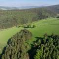
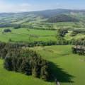
An attractive block of mixed grazings and mature woodland, in a scenic, but accessible location, suitable for equestrian or small-scale woodland planting use.
Commercial - Peebles
LOT 1
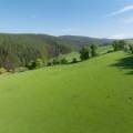
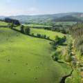
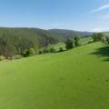
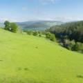
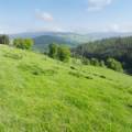
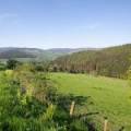
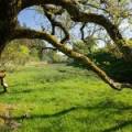
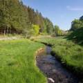
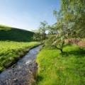
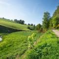
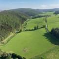
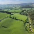
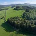
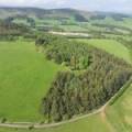
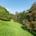
The land comprises two fields of mixed grassland, totalling approximately 9.69 hectares (23.94 acres), with parts being ploughable and the rest being in permanent pasture. Along the east side, at the foot of the slope, lies the Kirk Burn, which flows from south to north, with a number of associated mature and semi-mature “fence line” trees forming an attractive water margin and wetland habitat area.
The land has stock proof fencing, as well as a number of stone walls. Stock drinking is provided by a natural supply from the Kirk Burn. Access is taken directly off the Laverlaw public road by way of two existing field gates.
The land lies at a height of between approximately 170 metres above sea level, at the north-east corner, rising to approximately 245 metres above sea level, within the south-west corner. The topography is sloping with both moderate and steep slopes in places and all retaining a mainly east and north-east aspect.
The land would be suitable for equestrian use or small-scale woodland planting.
LOT 2
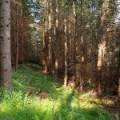
The woodland comprises an attractive block of mixed open areas and mature conifers, totalling approximately 1.49 hectares (3.68 acres). The trees are mainly Douglas Fir, though to have been planted around 1974, with a small number of other species and create a compact, but attractive area, offering the opportunity for woodfuel, woodland habitat management and amenity use.
Access is taken directly off the Laverlaw public road by way of a gate opening in the roadside wall.
A piped private water supply is provided to this area, but is not connected to any apparatus.
LOCATION
The land is located approximately two miles south-east of Peebles, one and a half miles west of Cardrona and twenty-six miles south of Edinburgh, within the River Tweed valley. The surrounding area comprises a mixture of similar agricultural and farm woodland areas, with mainly commercial forestry within Cardrona Forest, adjoining to the east.
DIRECTIONS
From the west end of Peebles High Street (Parish Church end), head south across Tweed Bridge on the B7062 (“Kingsmeadows Road”) and continue out of the town. Approximately two miles from the “30” limit, turn right onto a public side road (signposted “Laverlaw”). Continue uphill for approximately two hundred metres. The woodland is on the right and the land is on the left.
Post Code: EH45 9HT. It is strongly recommended that you do not rely on a Satnav in this rural location and check on a route map prior to any scheduled viewing.
What3Words: ///rejects.incorrect.cute
LAND USE CLASSIFICATION
The land is identified by the James Hutton Institute for agricultural use, all as Grade 4:2 and Classes F3 and F5 for forestry use.
INTEGRATED ADMINISTRATION AND CONTROL SYSTEM (IACS) & BASIC PAYMENT SCHEME (BPS) ENTITLEMENTS
All of the land is registered for IACS purposes and the grassland areas qualify for Region 1 Entitlement under the Basic Payment Scheme (BPS).
9.53 Units of BPS entitlements may be available to the purchaser by separate negotiation. Any payments relating to the 2024 scheme year will be retained by the Seller. If applicable, the purchaser will be responsible upon occupation of the subjects of sale to comply fully with the Statutory Management requirements to maintain the farmland in Good Agricultural and Environmental Condition (GAEC) as laid down under the scheme for the remainder of the scheme year.
All of the grassland is also subject to Less Favoured Area Support Scheme (LFASS) status.
The land is currently not subject to any Agri-Environment Climate Scheme (AECS).
TENURE
The land is offered on a Heritable title basis, with vacant possession.
THIRD PARTY RIGHTS AND SERVITUDES
The land is crossed by a mains electricity pole line.
The land is sold together with and subject to all existing rights of way, servitudes, wayleaves, and others, whether contained in the Title Deeds or otherwise and purchasers will be deemed to have satisfied themselves in all such respects.
ACCESS
Access to the land and woodland is taken directly off the Laverlaw public road.
ENVIRONMENTAL MATTERS
There are no Environmental Designations or Scheduled Ancient Monuments.
MINERAL RIGHTS AND SPORTING RIGHTS
Insofar as these rights form part of the seller’s title, they are included within the sale.
VIEWINGS AND FURTHER INFORMATION
For further information or to arrange an appointment to view please contact Walker Scott Ireland Ltd. Viewing is strictly by appointment. Please note that the fields may be grazed by stock (cattle and sheep) at the time of viewing and viewers must take all steps not to unduly disturb stock or put themselves in danger by approaching stock in a manner that might cause them disturbance.
Interested parties are advised to note interest with Walker Scott Ireland Ltd in order to be kept informed of any closing date that is set. Please note, our client need not accept the highest offer, nor indeed any offer.
ANTI-MONEY LAUNDERING REGULATIONS
To comply with current Anti-Money Laundering Regulations, any offer presented must be accompanied with Notarised/certified photographic evidence of the purchaser’s identity and separate evidence of the purchaser’s residential address, or the offering parties must attend our offices with the original documents, before any acceptance of the offer can be confirmed and the property put “Under Offer”.
SELLER’S SOLICITORS
Lindsays LLP
Caledonian Exchange
19A Canning St
Edinburgh
EH3 8HE
Tel: 0131 229 1212
W: www.lindsays.co.uk
LOCAL AUTHORITY
Scottish Borders Council
Newtown St Boswells
Melrose
TD6 0SA
Tel: 01835 824000
W: www.scotborders.gov.uk
SCOTTISH GOVERNMENT RURAL PAYMENTS & INSPECTIONS DIVISION
Local Office – Cotgreen Road
Tweedbank
Galashiels
TD1 3SG
Tel: 0300 2441400
FORESTRY AND LAND SCOTLAND
South Region
Tel: 0300 067 6900
Property Features
- Land is 11.18 hectare


